Navstar: Sailing By The Stars
- Transcript
I'm Marvin Kremer. I'm a retired geographer and I have ventured across the Atlantic Ocean six times in a 30 foot ketch. It is my belief that navigation across oceans can be accomplished without the use of instruments. The idea of crossing the Atlantic without using navigational equipment developed slowly during the long periods of night watch on a small boat in the Atlantic during the first four crossings I had abundant time for reflecting on the accomplishments of the Norseman and how without compasses they might have solved their navigation problems. After a great deal of thought along with backyard and oceanic experimentation I developed a system to determine latitude from the stars just as Atlantic City has a fixed latitude 39 degrees 22 minutes. So do the stars. They get a star in the constellation lira has a latitude of 38 degrees 46 minutes. Therefore when you are out on the ocean and
directly under Vega during its meridian transit you are near the latitude of Atlantic City. It occurred to me that when a pivoting line drawn between the North Star and the latitude star coincided with the observer's Meridian. That is his north south line the latitude star would be at right in transit. Longitude and direction depend upon more subtle complex kinds of information longitude would have to be distilled from both our speed and our direction into how far we had traveled in an east west direction. Power to our steering direction would have to be determined from the rising and setting sun and the stars in cloudy weather direction would have to be determined from Wave directions aligned with the directional information previously taken from the stars and sun. The voice would be a journey along a vague kind of highway built out of stars the sun and the direction of waves and
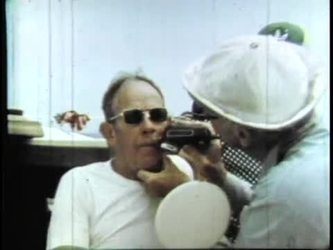
swells high road signs would be the stars whose declinations corresponded to the latitudes of our destinations. First the Azores. Next the Cape Verde Islands and then on the car Senegal on the western coast of Africa on the return voyage we would try for Bermuda and then home to Atlantic City by mid-July before the hurricanes of summer arrived with a crew of three. I would be sailing a 39 foot sloop called nav star. Because of strong east winds on April 9th Cramer and his crew delayed their departure so on a sunny April 11th 1980 they left Farley marina in Atlantic City to begin circumnavigation of the North Atlantic without using any navigational instruments. The crew of NAV star was first mate and ship's doctor Edgar Gibson a retired surgeon. Thirty six year old ship builder Gary Doyle all around handyman
in charge of camera work during the expedition and William Nichols a recent graduate from college. The first destination was the A's ors a group of volcanic islands belonging to Portugal. Their latitude is approximately the same as that of Atlantic City as they left behind their coast guard escort they headed directly east. The stars score and Gamble way to where their latitude references. I guess the Vikings were here I was Eric the Red Leif so lucky these fellows are able to take a boat to go from one side of the ocean to the other find their way there land on the shore and go back to Europe and then go back and
find a place again. That always intrigued me how they could go back to a place where they had left perhaps settlers or had been before. Part of Kramer's strategy to navigate over and back was steering gear that would maintain a constant angle with reference to the wind. If the boat changes direction the wind pushes the long vertical plywood beam down which then twists the trailing or swing re-establishes now stars of course aligned with the wind that would carry them to the AIDS orphans. They were making good time at the outset and soon settled into the voyage cleaning up after meals and splicing safety exploring the ocean and attending to minor adjustments and cleaning up after more. In essence what we're doing is reading our way
across the ocean. We're taking clues from the sky both day and night and we're taking clues from the water itself the wave patterns on top of the water and the color and temperature of the water. In order to find our way around if we can do it the ancients could have done it. And it may lead researchers into greater understanding of our own past. After turning north to find better when the weather was mostly cloudy and often stormy. The mental perception in a storm is that you could cash in your chips at any instant in time. It could happen that the that the super wave is going to hit you break your bones apart and you're going to drown. You do better if you keep yourself from thinking about the dangers.
If I get tight I'm less likely to survive. Because of the rough seas and clouded over skies it was difficult to get a latitude of reference from the stars. During this time of uncertainty they cited ships suggesting they were crossing a shipping lane possibly near the shore but the hurricane winds that came with a late summer made them go on rather than spend too much time looking for the Portuguese archipelago. They veered south towards the Cape Barren Island using Diablo to reach their latitude with a change of course came a change of weather and luck. A line thrown overboard for 28 hours caught of the Rato and food for days to come. Due to the direction of the wind and its strength they again turned off from their intended course and sailed on towards Dakar aiming north of their goal in order to have the coastal winds and currents with them on the thirty fifth day at sea they spotted a change in water
color signaling the approach towards the African continent. They then attuned themselves to clues that warned of the imminent approach of land and hope they didn't reach their goal at night. We had selected that car as our African port because it was a climatic boundary. North is desert Sask green vegetation. Early on the hazy morning of the thirty ninth day at sea Kramer spotted what appeared to be desert vegetation on the horizon. As they approached and the light grew the form of the Sahara took shape. They turned right and edge their way down the coast of Africa towards Dakar power leveling it during the day and sailing off at night as Navistar progressed along the coastline they look for clues to identify their exact location. Or doc Gibson and for William Nichols It would be their first time in Senegal. Or Gary Doyle. It was a return to the Peace Corps day and for Marvin Kramer It was a geographer delight.
I feel rather strongly that a person born on this planet Earth will feel much more comfortable about his existence if he knows what the Earth is like to know only his small area is not really to know the extent of his possible experience and knowing about the earth and many of its facets is to know one's self in a way because it does tell you the potential for life here on this earth. And I say to you that you don't have to live the life that you were born to. There may be another life elsewhere that you could live. It knocks the walls out of the box so to speak gives you horizons that are much farther away than you might otherwise experience. And I suppose there's been personal fulfillment for me in finding out about the extent of the earth itself what it's like in other places and what the people
are like. Before they would set off again Navistar had to be ready for the return voyage which is which had gotten salt water in them had to be cleaned and lubricated. Rusty cans rearranged and generally get the boat ship shape. On the way over one of NASCAR's Jim how your dad frayed through in order to fix this it was necessary to go up in a bosun's chair to the top of the five storey mast.
The crew decided unanimously that the job with the captain. The cause of the problem was a too long cotter pin but it was easily fixed by bending it around. Nav star readied a left back car and bid farewell to a Gambian friend. They had spent two good weeks in Senegal's major port but were glad to be aiming out to sea. The winds that had blown so strong during their stay quieted the day of departure so they motored quietly out of the harbor nav star and her crew headed toward the Cape. Their dial ins with anticipation for none of them had ever been there but I've heard stories that these islands had not had an appreciable rainfall for 11 years. William Nichols had had to return home via plane but they were joined by a psychologist
can help for the return voyage. They would be using gamma Delphinus as their latitude guide for the islands which lie due west of Dakar. The way a school of porpoises tagged alongside bringing with them they hoped good luck. They hadn't gone far though when they were big and sailed us nap star on the left overs Well most of them took refuge down below. Or it was when only 17 degrees of latitude north of the equator but Doyle worked topside mending a torn sail. Hoping to appease the wind gods doc offered his moustache as a sacrifice. An electric shaver was safer than a blade on board a bouncing boat not long after. Luck changed. The wind sprang to life and again they were able to land a
fish this time a tuna that they pressure cooked and canned later to be used for tuna sandwiches. Now Navistar was making good pace towards the volcanic Cape Barren Island. Though tall visibility of the islands was cut down by the dust particles blown from the Sahara desert by the strong easterly winds. But during the early morning hours they spotted the volcanic shape of an island jutting out of the water. Native fishermen in a dugout canoe rigged with a sail told them excitedly that the island they saw was South Nicolaus. This meant that during the night they had sailed between two islands mio and Boa Vista. They had made good time five hundred miles in five days despite being because the wind gremlins they had invoked did
their job well. They set their course for salvage day Island at a harbor known as Port au ground. They docked alongside an ocean going tug with whom they traded expertise on a pocket calculator for 100 gallons of distilled water. Again they had noticed a changing problem high up and now stars ringing. This time Dock went up in the bosun's chair to see what he could do. There was a problem with a boot on the end of a spreader but Doc was able to fix this with some whippings made from the background why his underwater mask flippers and skivvies to remove the barnacle growth that had accumulated on the hull of the boat. The water and back our harbor had been too polluted to attempt this job. The morning of June 12 they set sail for Bermuda using Arcturus the orange yellow
star at the end of the great differ and Elf echo in the constellation Corona to gauge their northwesterly progress toward the latitude of Bermuda. They would make good time on their first 10 day. In order to make bread Kramer had rigged a pressure cooker with a twisted steering rod to mix the dough.
Once the dough was sufficiently mixed he would form it and set it in the pressure cooker outside. He then covered this with a plastic container creating a greenhouse effect to speed the yeast on its way. It was not a matter of time for the sun to do its work. After the yeast had risen he cooked the bread on the stove. Half an hour to a side. This bread was one of the staples of their voyage and there was always a waiting line for the crust of the freshly cooked bread. During this part of the voyage to the more northerly latitude of Bermuda they were able to use the
setting sun to steer by or during this time of year the sun sets north of west. The morning sun also served as a guide for making sure of their heading. So far they had covered eighteen hundred miles since leaving the Cape Barren islands but their luck changed in the Sargasso Sea. They had sailed into a windlass part of the ocean for nine days. They bobbed helplessly like a piece of sarcasm in the middle of the North Atlantic. And calm. It's not difficult to imagine that you have found a place in the ocean. Where no wind has ever been. And day after day you get renewed proof that you have blundered into a place where there is no wind. But on the tenth day their luck changed again. The winds began to blow when a passing boat altered its course towards Now Star. Her name they gave three blasts of the whistle and cheered them on their way. Sailors are always looking for omens
out on the open ocean. The name of the boat had been the name of one of their guiding star as they sailed towards Bermuda confident they would find their way. Well there is a vastness about the ocean that does free up the mind. I think some people are overwhelmed by it and maybe are beaten down by. But I think others are really freed by it. You're almost a free spirit out there. The whole world the whole universe is yours. It's right there you can almost touch it. Seems that the challenges of our ancestors. Are something that we read about in books these days. The challenges I suppose of the 20th and 21st centuries are those having to do with machines and devices and the manipulation of people.
One defines himself in terms of how he can influence. Other people. I'm probably old fashioned defining myself and in terms of skill in dealing with the environment in some way taking the unadorned elements of the environment and doing something with them. By this time they had reached the approximate latitude of Bermuda and were heading mostly west. Noon July 8th using the latitude readings from Zeta Hercules and gamma lira their reference stars for Bermuda. Kramer determined they were 32 degrees 25 minutes north which meant they were two miles north of Bermuda's latitude. They then headed south far enough so that when they turned west they would avoid the coral reefs north of
Bermuda. Not sure though whether or not they had already passed by these low lying islands. That night at 11 PM doc spotted the loom of Bermuda on the distant horizon. This was the gem of the NAF star's voyage for the Bermuda Islands are but a small point in the vast Atlantic and they had found them. It was during the early morning hours that they neared St. George's Harbor. Again health and flew the Stars and Stripes while Doc hoisted the mandatory yellow quarantine flag when sailing into a foreign port. Zeta Hercules and Galileo had guided them well. They felt a quiet sense of accomplishment sailing into port early in the morning as the every day began its bustle while docked in the historic port under dramatic clouds. The outside world began its curiosity about now star's voyage. They stayed only a short time and set off the morning of July 11 for the final leg of their trip.
They were joined by Tony do a journalist an experienced sailor. Bernie Oakley a veteran of the docks of Bermuda sent them on their way confident that they would find Atlantic City. They raise their general sale in order to catch the wins that would take them north westerly to New Jersey. The bright light of Vega in the constellation lira would be Kramer's guy. This was the time of year she reigns as Queen in the nighttime sky. Before they had left the side of land. And now star was beset by a more stormy weather. And unformed waterspout world by their stir and informed dramatically in the distance
but they sailed off untouched. Reminded though of the capriciousness of nature and the limits within which they were. Exposed. Basically it's a matter of orientation if you can figure out where you are how you fit in in a particular place what the elements are. Then you really feel at home there. You feel comfortable with it and if you can find your way around the world in a boat without navigation instruments you have really come to feel comfortable with the world that you live in. The approach of lad was signaled by the visit of a tired cowbird taking time out to check his navigation suit after a harbinger of their welcome home flew overhead. They had sailed over 8000 miles on the open seas
without using a single navigational instrument and had found their way home.
- Contributing Organization
- New Jersey Network (Trenton, New Jersey)
- AAPB ID
- cpb-aacip/259-0p0wsd8b
If you have more information about this item than what is given here, or if you have concerns about this record, we want to know! Contact us, indicating the AAPB ID (cpb-aacip/259-0p0wsd8b).
- Description
- Program Description
- Vintage New Jersey Public Broadcasting film selects about Marvin Creamer, Glassboro State college professor and sailor, the first recorded person to have sailed around the globe without the aid of navigational instruments.
- Description
- No Description
- Media type
- Moving Image
- Duration
- 00:26:11
- Credits
-
- AAPB Contributor Holdings
-
New Jersey Network
Identifier: 01-26637 (NJN ID)
Format: U-matic
Generation: Master
Duration: 00:30:00?
If you have a copy of this asset and would like us to add it to our catalog, please contact us.
- Citations
- Chicago: “Navstar: Sailing By The Stars,” New Jersey Network, American Archive of Public Broadcasting (GBH and the Library of Congress), Boston, MA and Washington, DC, accessed October 19, 2025, http://americanarchive.org/catalog/cpb-aacip-259-0p0wsd8b.
- MLA: “Navstar: Sailing By The Stars.” New Jersey Network, American Archive of Public Broadcasting (GBH and the Library of Congress), Boston, MA and Washington, DC. Web. October 19, 2025. <http://americanarchive.org/catalog/cpb-aacip-259-0p0wsd8b>.
- APA: Navstar: Sailing By The Stars. Boston, MA: New Jersey Network, American Archive of Public Broadcasting (GBH and the Library of Congress), Boston, MA and Washington, DC. Retrieved from http://americanarchive.org/catalog/cpb-aacip-259-0p0wsd8b