Surviving Columbus; Sc61; Interview with archaeologist Mike Marshall, Part 1
- Transcript
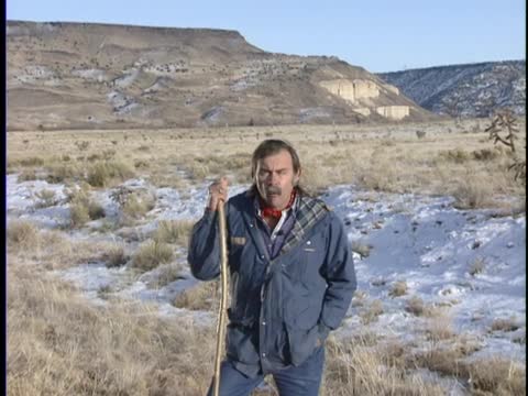
Yes. What? This depression that leads down across this country
here is the oldest and the longest road. The track that you see leading across this open plain here is the oldest and longest road in North America, which was known as the Camino Real de Tierra Adentro, the royal road to the interior lands. This road was opened in 1598 by the Spanish colonist Juan de Oñate and the first governor of New Mexico. It leads from the northern most mining colonies of Mexico to New Mexico across 750 miles of the Chihuahuan desert. Across this tract of empty country, the Spanish colonists came to inhabit New Mexico.
This path here, this depression right here, is the oldest and longest road in North America. It was called the Camino Real de Tierra Adentro, which meant the royal road to the interior lands. And the interior lands were New Mexico, distant from the northern mining colonies of Mexico by 750 miles. Up and down this road, for over three centuries, passed caravans of carretas and carros and great caravans of mule teams and carrying cargo and messages
from the northern colonies of Mexico into the public and province of New Mexico. The road was first opened in 1598 by Juan de Oñate and a band of some 700 colonists in 83 carretas bringing over 7 ,000 head of stock. It was a difficult journey. Oh, okay. It's getting a little better. This path here, this depression leading down through this country here, is one of the oldest and longest roads in North America. It was known as the Camino Real de Tierra Adentro or the royal road to the
interior lands. It led some 750 miles across a great empty desert and it linked the northern mining colonies of Mexico to the public and province of New Mexico. It was first opened in 1598 when Juan de Oñate and some 600 colonists crossed the country in 83 carretas and bringing 7 ,000 head of stock, among which were the first horses to be introduced into North America. The trail led across the vast empty desert of northern Chihuahua through the sand dunes and alkali plies and desert tracks from well to well, which these locations were called Parahes or campsites and which the colonists would stop. Many of the sections of the trail were also known as Horanada's and Horanada was a forced march across a waterless district from one water
hole to another. Sometimes these would take many days for the colonists to cross these areas and eventually this trail led to the Rio Grande River at a place called El Paso del Norte or the Pass of the North and from there the trail followed a couple hundred miles further up the river towards the pueblo and province where they first encountered the first pueblos in New Mexico at a place called La Calesa de Provencia or the head of the province. From this point on the trail proceeded up the Rio Grande River passing many of the great pueblos in the Rio Grande Valley. All together there were at least 60 Adobe pueblos which formed a chain of villages up the Rio Grande Valley. The trail led by many of these pueblos and came through this particular piece of country and came to the place called La Bajada, this largest skarpment in back of us. This was one of the most
difficult passages along the Camino Real. It was through this canyon that the the road led and this cut here is part of the Camino Real which was one of the oldest and longest wagon roads in North America. It was called the Camino Real de Tierra Dentro or the Royal Road to the interior lands because it linked the Spanish colonies of northern Mexico to the pueblo and province of New Mexico. It entered New Mexico at the Calesa de Provencia or the head of the province at the Puro Pueblo of San Antonio de Sanucu and then followed along the Rio del Norte or the Rio Grande River
along a chain of Adobe pueblos to what was eventually the capital at Santa Fe passing through this canyon here. The road came up the Rio Grande to the Pueblo of Isleta and from there proceeded to San Día and onto San Felipe, San Adomingo and from San Adomingo led through this canyon here which was called the Camino de las Bocas or the Canyon of the Mals which was one of the most difficult passages on the 700 mile road between the mining colonies of Peral and the Santa Fe capital. It was first passed by this depression here is the what's left of one of the oldest
and longest wagon roads in North America which was known as the Camino Real de Tierra Dentro or the Royal Road to the interior lands. This road led across the Chihuahuan Desert 700 miles from the northern mining colonies of Mexico to the Pueblo and Province of New Mexico. It first joined New Mexico at a place called the Head of the Province which was the southernmost town in New Mexico or Pueblo which was known as San Antonio de Sanucu. From there the road proceeded up the eastern bank of the Rio Grande River passing the pueblos of Isleta, San Día, San Felipe, San Adomingo and then across this plane and entering this canyon at La Bajara. This was one of the most difficult sections of passage along the Camino Real. This road was first opened by one day onñate and the Spanish colonists in 1598. The colonists brought 83
caretas or wagons approximately 600 people and 7 ,000 head of stock among which was a large herd of horses which was the first breeding herd of horses to be introduced into North America. What was that? Motion? Okay, can you give me a brief characterization of what the tail was along the trail? Well, let's see in a second. Well, the Camino Real Trail linked the provinces of northern New Spain from the mining colonies of Peral to the Pueblo and Province of New Mexico. Many of the products of New
Mexico that went down the trail were local products such as buffalo hides, pinion nuts, salt, the Camino Real was a lifeline between the northern colonies of New Spain and up that trail came many of the products that the Spanish colonists needed to live in this country. The earliest caravans such as the Mission Supply Service, that's more to my liking. Ready? The Camino Real extended across 700 miles of desert from the northern colonies of New Spain to the Pueblo and Province of New Mexico and down that avenue came many caravans. The trail was in use for over 300 years and as a result a conspicuous scar was left in the landscape of the desert province.
Up and down that trail passed products of commerce from the south to the north. The Spanish were supplied eventually from Spain up the Camino Real bringing various products such as olive jars and myolic containers and bringing all the products that were needed to sustain the Franciscan missions. Many of the products that went down the trail, the local products from New Mexico that were exported were hides such as buffalo hides from the plains, pinion nuts, salt, and a lot of sheep were exported to the minds of northern Mexico down the Camino Real. Many of the servants and slaves that were taken into Mexico were also taken down the Camino Real to the minds of northern Mexico. Okay,
let's go on. Okay, we talked about the nautical nature of the Camino Real, the Camino Real crossed a vast desert province and many of the historical journals relating to the Camino Real refer to this as a sea of land and compare it to the nautical journeys across the ocean. Indeed, a good deal of the transportation, the technology and the organization required to cross this province was learned by the Spanish people in their journeys across the sea. They needed to be independent and carry all of the products they needed for the journey. Many of these, for example, the water. Water was carried in olive jars across this desert because there was very little water and the trail led from the water hole to the water hole. Okay.
Well, the Camino Real was the first and longest wagon road in North America and this was a secular road. This was a road of commerce and exploration and colonization. When the Camino Real entered New Mexico, it crossed roads that had been abandoned for over 800 years and these roads had been constructed by the ancestors of the modern public people. These roads were pilgrimage avenues. When the Camino Real entered New Mexico, it crossed ancient roads that had been abandoned for over 800 years. These roads were constructed by the ancestors of the modern public people and had been part of a very complex cosmological system that existed across the plateau province of New Mexico. These roads were
constructed as pilgrimage avenues which linked the Pueblos of New Mexico to many of the sacred land forms. Many of these roads emanated from a location known as Chaco Canyon and articulated with with the topographic well, I'm sorry, I'm just I'm just I'm just not don't feel like I'm really doing the trail between
Spanish roads and blah blah blah. Okay, give me a short statement of what Chaco comes here. There were the Spanish and the Pueblo and people had essentially two diametrically opposed visions of the world and they're a place in the world. The Camino Real trail which entered the province from the south was a road of commerce and expansion. That road came into the state into the state. No, it wasn't. Relax.
Okay. The Pueblo and people and this Spanish colonists had two visions of their place in the universe. To the Pueblo and people the earth was their home. In the beginning they had emerged from the underworld and are said to have been earth born and from the Shippah in the north they traveled south looking for the middle place where they inhabited the Pueblos of this province. From the south the Spanish came opening up the Camino Real de Tierra de Dentro the royal road to the interior lands. This was a road
of commerce colonization leading to the Pueblo and Province. To the Pueblo and people New Mexico was the sacred middle place. The middle of the universe surrounded by the sacred mountains of the directions. To the Spaniard it was a remote and isolated colony in the far north. When the Camino Real came into the Pueblo and Province it crossed ancient roads that had been abandoned for over 800 years. These roads were constructed as pilgrimage avenues. Okay. I like to go back I like to go back to that again and try that again. I think you're doing really well. You're getting it together. Okay,
I'm okay. You think I should start all over again from that point or wherever, this wherever. The Pueblo and people and the Spanish colonists who entered this land had two visions. The Pueblo people and the Spanish colonists who entered this land had two visions. The Pueblo people and the Spanish colonists who entered this land had two different visions of their place in the universe. To the Pueblo people this was the sacred middle place. They had emerged in the beginning from the underworld and had traveled south on a mythic journey searching for the middle place. They had found the middle place and established their settlements among the four sacred mountains. The Camino Real established by the Spanish colonists led north
into this province across a vast desert wasteland and was considered by the Spanish to be a very isolated and remote area. Indeed it was referred to the region that was remote beyond compare or that miserable little kingdom. The Camino Real which led north into this province crossed many ancient roads established by the Pueblo people in an abandoned 800 years previous. These roads were sacred pilgrimage avenues which linked the Pueblos of the region to various land forms and sacred places. Whereas the Camino Real was a secular road of colonization and exploration. The Pueblo and roads were sacred avenues which integrated the
cosmology of the Pueblo people to the surrounding landscape. These were two different kinds of geography. The geography of inner space and the geography of the outside world. Important to the Pueblo people was the concept of the middle place. The middle place was sought for after the people left the underworld and established their Pueblos. The middle place was instrumental in the construction of the ancient roads. In Chaco Canyon many ancient roads were built some of which were directional corridors. Which helped to define Chaco Canyon as the cardinal middle place or sacred center of the universe.
Many of these roads were used as pilgrimage avenues which led to various kinds of topographic land forms, sacred mountains, entrances to the underworld caves and caverns. And this kind of construction which integrated Pueblo and architecture to the landscape was considerably different than the colonial system that was superimposed upon that. Indeed it remains today to be distinct. The modern interstate system of highways and the expanding urban grid across the southwestern United States
still lies upon the sacred landscape of the Pueblo people. Still lies within the four sacred mountains. The remnants of the ancient roadways of the Pueblo people and the early spending colonialists are today but scars on a empty desert land which reminds us of the long history and story of the Pueblo people in this land. Okay, what did you tell me is what you've done on the communal and why you found it interesting. What's my involvement in the communal realm?
Okay, let me see here. Well, let's see. Okay, I became interested in the study of this trail because it's the oldest and longest wagon road in North America and it's been abandoned for over a century and it was used for three centuries and that's probably longer than any road in North America and yet it was basically lost and unknown and
today it's defined by a very conspicuous scar across the desert landscape but it's grown in vegetation follows along it or it's scattered along and are the remnants of over three centuries of Spanish colonial traffic, scattered artifacts and campsites and that sort of thing and the road is very important to the story of New Mexico and to the story of the Pueblo Indian people because it brought with it the currents of change that forever changed the Pueblo world. It brought the colonists in 1598, 600 colonists, 7 ,000 head of stock, a large horse herd which was the breeding stock of the first horse surgeon in North America and also
saw a lot of traffic of commerce it brought it brought basically the European world into this section of North America. The Chacoan roads have been abandoned for over 800 years and they were first really recognized in aerial photography and in satellite imagery as these very conspicuous linear scars across the landscape leading out from the multi -story Pueblos of the Anasazi, the ancestors to the modern Pueblo people. Abandoned for over 800 years and yet a line on the desert floor. At first we thought that it was a transportation network but as the study of this road system continued
it became obvious that these roads were not part of a network, a transportation cord or a system of commerce that the roads led for many of the sacred buildings especially in the Chacoan province to various kinds of land forms and it became obvious that the Chacoan road system was a cosmological network and that they were built to provide a corridor between the architecture of the Pueblos and the landscape and thereby integrated the Pueblos to the landscape and served in a way to codify the relationship of the Pueblo and the people to the earth. Some of these roads were
directional corridors such as the Great North Road which led from Chaco Canyon North for over 50 kilometers. This road is believed to be the avenue, metaphoric avenue to the underworld who once the Pueblo people emerged in the beginning coming south seeking the middle place. Many of the roads helped to define various Pueblos as the middle place.
- Program
- Surviving Columbus
- Episode Number
- Sc61
- Contributing Organization
- New Mexico PBS (Albuquerque, New Mexico)
- AAPB ID
- cpb-aacip-191-75dbs2w3
If you have more information about this item than what is given here, or if you have concerns about this record, we want to know! Contact us, indicating the AAPB ID (cpb-aacip-191-75dbs2w3).
- Description
- Description
- Surviving Columbus #61, Mike Marschall, La Bajada/Camino de Real, 1-2-92.
- Media type
- Moving Image
- Duration
- 00:31:15.608
- Credits
-
-
Interviewee: Marshall, Mike
Producer: Edmund J. Ladd
Producer: Larry, Walsh
- AAPB Contributor Holdings
-
KNME
Identifier: cpb-aacip-c969befec1d (Filename)
Format: Betacam: SP
Generation: Master
Duration: 00:30:00
-
KNME
Identifier: cpb-aacip-5de9dbf12d0 (Filename)
Format: Betacam: SP
Generation: Master
Duration: 00:30:00
If you have a copy of this asset and would like us to add it to our catalog, please contact us.
- Citations
- Chicago: “Surviving Columbus; Sc61; Interview with archaeologist Mike Marshall, Part 1,” New Mexico PBS, American Archive of Public Broadcasting (GBH and the Library of Congress), Boston, MA and Washington, DC, accessed April 9, 2026, http://americanarchive.org/catalog/cpb-aacip-191-75dbs2w3.
- MLA: “Surviving Columbus; Sc61; Interview with archaeologist Mike Marshall, Part 1.” New Mexico PBS, American Archive of Public Broadcasting (GBH and the Library of Congress), Boston, MA and Washington, DC. Web. April 9, 2026. <http://americanarchive.org/catalog/cpb-aacip-191-75dbs2w3>.
- APA: Surviving Columbus; Sc61; Interview with archaeologist Mike Marshall, Part 1. Boston, MA: New Mexico PBS, American Archive of Public Broadcasting (GBH and the Library of Congress), Boston, MA and Washington, DC. Retrieved from http://americanarchive.org/catalog/cpb-aacip-191-75dbs2w3