¡Colores!; 1605; Sleeping Monsters, Sacred Fires: Volcanos Of New Mexico; Colores Volcanoes #2
- Transcript
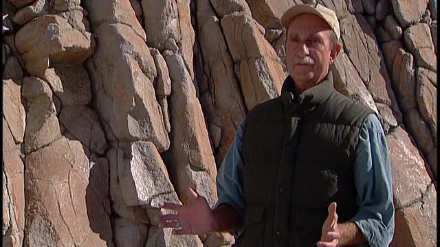
but I was thinking of bringing some of the maps I bring along for field trips I always mentioned. What would you call the lenium in a volcanic feature or describe it as the other, how are you describing it as the other major thing that affects the direction? The vius caldera and the haemus volcanic field on which vius caldera sits is a long live volcanic center. It's been erupting continuously more or less for the last 13 or 14 million years. It's probably no accident where it occurs. It occurs at the intersection of the Rio Grande Rift, a north trending tectonic feature, and the crosscutting haemus liniment, which trends northeast across northern New Mexico.
The haemus liniment is a controversial geologic feature. It's an alignment of volcanic senders that stretches from Arizona into northeast in Mexico. So the tautos volcanic field is on the liniment. The haemus volcanic field and vius caldera is on the liniment. Mount Taylor and a zoonibandera volcanic field and San Carlos basalt field down in Arizona is on the liniment. But the thing that's key is that the haemus volcanic field is by far and away the largest volcanic center. And that's because it occurs at the intersection of these two features, the haemus liniment and the Rio Grande Rift. Volumetrically, there's about two or three thousand cubic kilometers of eruptive products still remaining here at the haemus volcanic field. And nothing else comes close to that on the liniment. I don't know the general question people
are asking. Is there anything that's that's any possible even eruption of course through the state somewhere through the state? Well, throughout this well here, we're here. Sure. Sure. I guess people have a magma body. It's a cura magma body. But yeah, just in general, I ask that answer that you. Now people always ask me if vius caldera is going to erupt again. You know, it's certainly hot down there. With the geophysical data we have, we know that there's probably a pot of crystallizing magma beneath the caldera. The youngest eruption in vius is about 40 ,000 years ago. You could make some estimates on eruption frequency based on the number of post caldera eruptions here. And well, I mean, probably there'll be another eruption, but it probably won't happen in our lifetime. The eruption frequency averages about one eruption per 100 ,000 years. Youngest eruptions 40 ,000 years ago.
So don't hold your breath. But throughout the state, there's other young eruptions. Our young lava flows. The McCarty's flow over near grants is about 3 ,500 years. There's a young other young lava flows in that area that date from 10 ,000 years and older over at the area around Alamogordo. There's the Carizzo flow. I can't remember the actual eruption age of that, but it's pretty young. So yeah, probably there'll be another eruption somewhere in this state. I mean, the state is just full of volcanic rocks and there's plenty of young eruptions here. So the chances are that there could be an eruption in our lifetime. Well, maybe I shouldn't say that. You better cut that part. Okay, that's a pretty evolved question, actually, but I could address that. The point we need to cross is that
that means that these are places where magma is more likely to break through. I mean, is that what you're trying to get at? I think it was more directing towards via the depth to the magma chamber and things like that. It's a combination of mantle and melted crust. Frictional crust. Well, you know, all this basalt magma is probably rising in this area because we have the rift, we have thin crust. So as the as this basalt magma gets into the lower crust, it melts the crust and helps to generate magma of bodies. And we know from seismic. We can do that picture. And we know from the seismic data that the top of the magma chamber is about five to seven kilometers down. Okay, you guys good? I'm looking for my problem.
Magpie's not the end. No, he's gone. That's a good shot. Alright. Yeah, one of the biggest barehand ops. And now it's the best time to look it out to say it's the same thing,
but that's, uh, I think levels haven't
changed. Keep an eye on that. Yeah, we're located in the Redondo Creek Graben. A Graben is a fault controlled valley, and this valley is within the resurgent dome of Vias Caldera. It's also the location where the geothermal reservoir was discovered, improved. And this big flat area was going to be the location of the 20 megawatt geothermal power plant to exploit the geothermal resource in this valley. The depth to the resource is about 2 ,000 feet, and it extends for another 5 ,000 feet, and the temperature is about 200 to 300 centigrade, so it's up to 650 Fahrenheit. Yeah, the geothermal reservoir, it's a reservoir
of hot liquid water. It's at a depth of about 2 ,000 feet, and it extends down to about 7 ,000 feet. And the temperature ranges from 200 to 300 centigrade, so the hottest temperatures are about 650 Fahrenheit. And so there was a series of wells drilled in this valley, about 24, and the object was to produce hot water and steam, and direct the steam to turbines at the power plant. The steam would spin the turbines, which would spin generators, and generate electricity. Explain for in geological terms why the water is so hot here. And the reason that the reservoir is here is because, well, it's a young caldera, there's still a lot of heat down there. We know that the depths of the magma chamber is 5 to 7 kilometers. You know, magma is going to be at a temperature of 800, 900 centigrade, so all that heat heats up groundwater, and so you get a geothermal resource developed on top of the magma chamber in the
subsurface. Again, I explain to just another little sound by about when you said the term resource. When you drill down, I wouldn't find it exactly. So when you drill anywhere in this area, you hit a geothermal reservoir of hot water in a depth of about 2 ,000 feet. And that water can be made to flow up the wells, and then piped to the power plant. That was the intent. How big a reservoir are we talking about? So from about 1970 through the early 80s Union Oil Company of California was trying to develop this geothermal reservoir, and over time they drilled about 24 wells. And the sad thing is that only six of the wells were really commercial producers. In other words, wells that could produce enough steam that it could really provide power to a
power plant. But the total of those wells was only 20 megawatts. And 20 megawatts, well, what happened is that they promised 400 megawatts. That was the promise that Union Oil made. And so they did a joint project with the U .S. Department of Energy and with public service company of New Mexico. And in the early 80s, this flat area was created to house the power plant. Public service company of New Mexico bought two 25 megawatt turbines. And we're going to put them in here. And once Union Oil approved out, they had enough steam. But finally, Union Oil said that we only have 20. And so the power plant was never developed. Public service company of New Mexico sold the turbines to the Mexican government for pennies on the dollar. And those two turbines are now in operation, have been for the last 25 years,
down in Mexico at a geothermal field called Los Asufras. So this was quite a disappointment because 400 megawatts were proven. Turbans were bought this big flat area for a power plant was developed with this nice expensive retaining wall and all this rip wrap. And nothing happened because Union Oil couldn't produce the power. Is geothermal energy always a feature of cold airs? No. Geothermal energy is commonly produced around active volcanoes or young volcanoes. So the best geothermal fields around the world are adjacent to or within young volcanoes. Cold airs are just one class of volcanoes. So some geothermal fields are successfully developed in cold airs. Others are successfully developed on and decide volcanoes like you find in island arcs, places like Japan, Indonesia, the Philippines. They have, there's big geothermal fields at those volcanoes.
Megawatts. So 20 megawatts, that's sort of a vague number. What does that really mean? A megawatt in the U .S. about one megawatt is enough electricity for a thousand people to give you an idea of what a megawatt will do. Big nuclear power plants produce 2 ,000 to 3 ,000 megawatts. Big coal -fired power plants such as in the four corners region produce 1 ,500 to 3 ,000 megawatts of electricity. So a 20 megawatt power plant or 20 megawatts is kind of a drop in the bucket in New Mexico because New Mexico is energy rich. We have all this oil and gas and coal and uranium resources. Union oil wasn't interested in a 20 megawatt resource. So then the minimum is 50. So once they decided they couldn't produce more than 20. They left the project dissolved between Dewey, Public Service Company in New Mexico and Unical.
No. And when they were going to put the plant here, it didn't look like this. This was reclaimed. Yeah, I mean, if you look at the terrain around here before they bulldozed this area flat, it was sort of this mountainous sloping terrain with trees and everything. You know, there's a honeycomb of wells and roads that access the well pads. So when they got finished, you'd see roads all over the place and, you know, well heads all over the place. And with pipelines that direct the flow from the productive wells to the power plant. And so all this has been disturbed land. In fact, one of the wells, one of the productive wells is right over here, right behind you.
The top of the reservoir is roughly 2 ,000 feet down. They produce from deep inside the reservoir. So production temperatures were 300 to 260 centigrade. But like I said, of all the wells drilled, only five or six were real producers. The rest are considered kind of losers. And at one or two million bucks a while, that's kind of expensive. You
You You You
You You You
You You and I used to like this to see if, okay, my name is
Anna Steffen. I'm the cultural resource coordinator here at the Viaskold era National Preserve. Oh, and my first name is, you know, my whole name are my, what I call myself. Okay, how do you want us to identify you on the screen? Okay, it's Anna Stephens, it's first name is A &A, the last name is S -T -E -F -F -E -N. Okay. All right. All right. Okay. Just, you know, tell people where we are in, you know, obviously, inside the bias, but where inside the bias and about this particular area and the significance of it, we'll open there. Okay. Well, we're on the north side of Ceradolmedio, which is one of the volcanic domes on the interior of the Viaskold era, inside the preserve. This particular location is a very large, very rich obsidian quarry on the north side of Ceradolmedio. It's a newly recorded location. We've been doing surveys out here since about 2001, and we knew that there were quarries like this all over the mountain, we've recorded some of them, documented some of them,
but this is one that we found about five weeks ago for the first time. And what is the significance of this biggest quarry or in this bias or preference? Well, probably, this quarry is extensive. It goes on for a kilometer in either direction, and it's really the whole ridge that we're standing on. So it is a large quarry, perhaps maybe not the largest quarry, but what it is is it's just very densely, the ground is covered with dense material that's both natural material that the people were using in prehistory, but also the debris and the remnants of all the many hundreds of years that people have been coming here and breaking up the stone and using the glass and using it to make stone tools and to carry it away. Explain real briefly how the obsidian gets there. What is the volcanic process that creates this? Ceradolmedio is an extrusive volcanic source of obsidian, and that means that in this particular case, the obsidian is forming by the warmer hot lava
sort of squishing up from underground and building a dome. So the dome is built more or less in the way that we're familiar with seeing volcanoes. And that means that the glass here is super high quality and also comes in very large sizes. So the glass tends to be a ferric meaning, it doesn't have a lot of crystals in it. So it's particularly good for making stone tools. So the warm lava is oozing up from underground and then cooling quickly to form the glass. How long do archaeologists think people have been living or traveling through the biased area? Well, the Caldera is a new area for archaeological research. It's been closed because it was privately owned until just five years ago. So we haven't done as much archaeological research as many other federally owned lands here in the West. What we know so far, we have evidence of human occupation out here for as long as the Western
United States has been occupied. So certainly at least 10 ,000 years ago people have been here. And we can tell that by the types of stone tools that we find, we find particular kinds of spear points and other projectiles that date way back to the Paleo -Indian period. And we have documented evidence for that within all the years in between as well. Probably this has been continually used by people for the last 10 ,000 years. And this changed time itself. Watch yourself.
- Series
- ¡Colores!
- Episode Number
- 1605
- Raw Footage
- Colores Volcanoes #2
- Contributing Organization
- New Mexico PBS (Albuquerque, New Mexico)
- AAPB ID
- cpb-aacip-191-50tqjw11
If you have more information about this item than what is given here, or if you have concerns about this record, we want to know! Contact us, indicating the AAPB ID (cpb-aacip-191-50tqjw11).
- Description
- Description
- Fraser Goff
- Media type
- Moving Image
- Duration
- 00:33:40.452
- Credits
-
-
Interviewee: Steffen, Ana
Interviewee: Goff, Fraser
Producer: Dellaflora, Tony
- AAPB Contributor Holdings
-
KNME
Identifier: cpb-aacip-4292e2f8ed8 (Filename)
Format: DVCPRO
Generation: Master
Duration: 01:00:00
-
KNME
Identifier: cpb-aacip-ddd9c998ffa (Filename)
Format: DVCPRO
Generation: Master
Duration: 01:00:00
If you have a copy of this asset and would like us to add it to our catalog, please contact us.
- Citations
- Chicago: “¡Colores!; 1605; Sleeping Monsters, Sacred Fires: Volcanos Of New Mexico; Colores Volcanoes #2,” New Mexico PBS, American Archive of Public Broadcasting (GBH and the Library of Congress), Boston, MA and Washington, DC, accessed August 5, 2025, http://americanarchive.org/catalog/cpb-aacip-191-50tqjw11.
- MLA: “¡Colores!; 1605; Sleeping Monsters, Sacred Fires: Volcanos Of New Mexico; Colores Volcanoes #2.” New Mexico PBS, American Archive of Public Broadcasting (GBH and the Library of Congress), Boston, MA and Washington, DC. Web. August 5, 2025. <http://americanarchive.org/catalog/cpb-aacip-191-50tqjw11>.
- APA: ¡Colores!; 1605; Sleeping Monsters, Sacred Fires: Volcanos Of New Mexico; Colores Volcanoes #2. Boston, MA: New Mexico PBS, American Archive of Public Broadcasting (GBH and the Library of Congress), Boston, MA and Washington, DC. Retrieved from http://americanarchive.org/catalog/cpb-aacip-191-50tqjw11