Sierra In Peril- SF 129
- Transcript
There's just. No. Way. There were these are all camera questions right. These are all the way to. Florida. For years you might say well if you give us a name we're transcribers right now Stephen. STV ph W. Branko B R A N C O have a county planning department taking over. My starkest or the person with this map because she actually does. There is quite a few of mine the idea of a DS an amateur accounting terribly going on in the mainly the I own area this is called the IO information
because a lot of clay and some of the deposits are located in and around the city of I own. There are some gravel deposits that are being mined and also two mines that are currently mining lignite which is a form of coal. Those two mines are governed mainly by the federal government not the state of California because they are coal considered coal mines currently. Historically the gold mines of the motherlode were along the motherlode strip which follows just east of Highway 49 in amatory County and extends as you know north and south into other counties. The lignite deposits of course like I mentioned are in the Bonavista area and the there's another mine up here north of Iowa. The clay deposits are and have been there traditionally for many years
and mostly those mines have been they were grandfathered in even before what we call grandfathered in they were existing prior to zoning and state regulations. They are regulated today through state and county reclamation acts. The latest mine that it was current was the most controversial and in quite a few years has been a mining operation for a. It was located between an inner city and Sutter Creek It is a gold mining operation they tunneled about a mile or so into the ground to find the gold. So thats the tailings in the hand the lot of the gravel and dirt that come out of the mine have been have been the controversial part of it because they had to be stockpiled around the mine operation there.
And you know I showed her hands anyway in this area right here and you. Can just just tell you know more about it. We want the current mining operations consist of clay mining in the what they call the I own formation of Amador County which is north and south of the city of I own the lignite operations that I mentioned are in what they call the Bonavista area of amateur County. And just in various spots just north of the city of I own the Lincoln project is an between our city in Sutter Creek just east of Highway 88 real small gold mines that still exist are one man operations up by volcano and pine grove which are just like I mentioned one man operations the beer store ical
motherlode is just east of Highway 49 and extends across the county just like that. Over here yes. And here. The current clay mine operations exist in the information north and south of the city of Iowa. Actually I made a point then you're OK with the current clay formations in the I own formation are in this area and in this area also the United mind which is an early form of coal are in the Bonavista area and up in this area also the most controversial mine in the county in the last few years has been a gold mine that
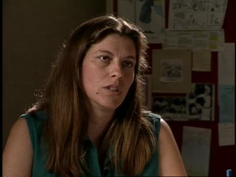
is in between the outer city and Sutter Creek right over their area. And they know why this is. It is an important economic base in the county available. Sure Marni was and still is an important economic base in the county and it goes to generate a lot of tax revenue dollars. For testing testing one two three. Good morning. So you need to go in just give us your name in the spelling and your position at the Department of Corrections. OK. I'm Susan. I'm the chief planner with the L.A. County Planning Department. Last name is spelled
g r I J K L V A. Oh ok we will. OK so let's go and give us an idea of how the controversy initially started with the controversy is really about well the controversy originally started when a group of landowners and homeowners in the area most of them went in Amador city were concerned about the impacts the project would have on their area. The project lies essentially halfway between the cities of Sutter Creek and Amador city. Most of both of them are historic towns communities tourism is a large part of their trade so they were concerned about what the project would do to their their communities. So once what had to be done to miliary those factors between you so that's it. Oh well lots of things. Conditions of approval were placed on the project that were designed to eliminate or at least mitigate to an acceptable level. The concerns that people had for traffic noise
dust things along those lines. The environmental concerns that they had. Now that the project is up and running and it well they're not up and running is there. OK OK OK. They have a conditional use permit that once they meet the requirements of the conditions and on the use permit they can start operation. The project was only approved last August and they figure it'll be a year year and a half before they have all the permits that they need from the state agencies as well as of the local agencies before they can actually start construction of the project. Once construction is completed then they can start the actual mining and milling process as it's only begun. The decline was started in 1907 I believe and it was done to gather data that was used to help us approve the project essentially be the decline is what it's called is about 27 Twenty eight hundred feet I believe deep and it's on
an incline and that you can walk down and it is very interesting if you can get the opportunity go down there. But they used it to gather data about the ore bodies as well as other things blasting vibration data because they will be doing blasting. So it is there it will be extended deeper into the ground as well as they will go off on you know off shoots and because of the cold drifts it when they get to do actually start the mining. How about the tailings. The more unsightly aspect of it how are the locals doing that. That was a big concern the visual aspects. There is currently a tailings pile if you want to call it's a waste pile they call it out in front of the portal. A lot of that rock will be used in the construction of the dams that will be used for tailings ponds as well as the road. Some of the roads that they will have to put in to bring the truck traffic in they'll use that rock
the rest of it will be used in the construction of the dams and there will be waste rock piles that will have to be reclaimed over a period of time as they grow. It is that ongoing process that they are to try and keep them is visually pleasing as possible. How do the locals respond. Right now it's a wait and see attitude I think the people who are involved with the project. We called kind of watch dogging it once it starts construction I'm sure they'll be watching it again there is a Citizens Advisory Committee that will be able to meet with the mine in the county once they're under construction and operation and hopefully it will work out some of the concerns they have that maybe weren't addressed. You can't on a project this size you can't address all the problems before it even gets off the ground. Then it all mature and it'll evolve over time and so things will have to be dealt with as they come up and that the Citizens Advisory Committee is set
set up to do to deal with those things. There's the concerns of the people who belong to the foothill Conservancy happen to also be some of the same people who are concerned with the project. It's not a foothill Conservancy concern. No but it just happens to be some of the same people work and expected revenues that you get out of those moments that this is a big operation. Yeah that would be something that the mine operators could tell you a little more about. We don't really concern ourselves at this point with those kinds of things I'm sure our assessors office our tax collector will be very interested in those things once they start producing or. But at this time it's just not anything that I don't keep those figures in my head. OK. Anything else you're going to do since you did. Ha no not really. This area historically you know that we are here because of the gold in the ground. All of our own mother Knode communities are here. They're you know constructed basically on top of the ore bodies if they're still there which a lot of people believe they
are this kind of indicates that they are they you know we're here for that reason and yet those for that same reason it causes concerns and impacts for anybody trying to come back in and retrieve that goal because you do have communities on top of these areas you know blasting down below is going to cause people concern. There's water issues where the blasting is going to to you know affect wells and those kinds of things. But we're just kind of taking a wait and see attitude there's a mine in Washington which we did go visit one of the people who was on the opposition. And I myself went to when achey Washington to see a mine that literally is one city block city lot away from this town boundary and it was very interesting it was very educational. We were both I think pleasantly surprised at how quiet the operation can be. I won't say that it's always
going to be pretty because it will there will be bare dirt at times and there are going to be things that you know aren't going to be like what it looks like now but boy going up there we said we saw that it wasn't as bad a project I think is a lot of people had anticipated that it could be done and acceptable to the area. And that was a very educational trip that we took. The things that think that. That's it. So you put those back on that one. Right well you can hear my read
of the letter Pam. What is it. Some louder. That's us and you. That will happen right. You know you feel one. Yes.
Yeah he's not you know he's going to. Talk. During a no. But he's been with three other people right now. You're right. Yeah. Well I can transfer you down you can talk to Karen and see if she knows where it is. OK hang
on a second. Sorry Andy I dialed the wrong number. By Earth hang on I dialed the wrong number. Usually I dial the other way too close. Hi Karen I have Ruth here she's trying to track down some of the courthouse construction standards that she gave to Otto before he left. Can you help her. Possibly. Well who hasn't. Is that what he took. Just the last thing you want to tell her that. Ok thanks bye bye.
Bye. Doubt it.
That's. Right.
All. Right.
Do. We. Want to. Run. But we're. Not.
Really. Building. One. Will. That. Remark. Bring it over and. Over here. Three. Three. Point. Line. About. That. Water. Thing. There. Over. The. Water. With. The. Salt.
Water. They want. Water. There is. Basically kill the fatted to the water. Would. Drop the DA. Back up. To bring. Ph. Back up. And then my. Mother from. Here on was.
- Raw Footage
- Sierra In Peril- SF 129
- Producing Organization
- KVIE (Television station : Sacramento, Calif.)
- Contributing Organization
- KVIE (Sacramento, California)
- AAPB ID
- cpb-aacip/86-45q83h6s
If you have more information about this item than what is given here, or if you have concerns about this record, we want to know! Contact us, indicating the AAPB ID (cpb-aacip/86-45q83h6s).
- Description
- Description
- Green trees, bushes, grass, PR Foggy mountain scenes CU of plants swaying in the wind Cars driving up highway, PL to Sierras IS of Steven W. Branco, County Planner, showing map and talking about gold mines Is of Susan Grijalva, County Planner Stephen W. Branco, county planner, sits at his desk Susan Grijalva, County Planner, at her desk in office Hawk flies through blue sky PL across field to buildings, ZI on for sale-homes Track houses Trees and grass, camera moves down pathway to a view of mine Car drives down mining tunnel Miners in tunnel with headlamps, walk into lighted pump room, worker describes pump and filtration process
- Asset type
- Raw Footage
- Genres
- Magazine
- Topics
- Environment
- Rights
- Unknown
- Media type
- Moving Image
- Duration
- 00:30:17
- Credits
-
-
Copyright Holder: KVIE
Producing Organization: KVIE (Television station : Sacramento, Calif.)
- AAPB Contributor Holdings
-
KVIE
Identifier: AID 0003949 (KVIE Asset Barcode)
Format: Betacam: SP
Generation: Original
Duration: 00:30:00?
If you have a copy of this asset and would like us to add it to our catalog, please contact us.
- Citations
- Chicago: “Sierra In Peril- SF 129,” KVIE, American Archive of Public Broadcasting (GBH and the Library of Congress), Boston, MA and Washington, DC, accessed May 17, 2025, http://americanarchive.org/catalog/cpb-aacip-86-45q83h6s.
- MLA: “Sierra In Peril- SF 129.” KVIE, American Archive of Public Broadcasting (GBH and the Library of Congress), Boston, MA and Washington, DC. Web. May 17, 2025. <http://americanarchive.org/catalog/cpb-aacip-86-45q83h6s>.
- APA: Sierra In Peril- SF 129. Boston, MA: KVIE, American Archive of Public Broadcasting (GBH and the Library of Congress), Boston, MA and Washington, DC. Retrieved from http://americanarchive.org/catalog/cpb-aacip-86-45q83h6s