Land Between Two Rivers; 105-Is; Little Sioux River: The, Part 1
- Transcript
Oh OK. Oh. The following program is made possible through a grant from the kidney and Lindstrom foundation incorporated a charitable trust Mason City Iowa. During our last program we began our look at the Little Sioux River as it wanders through a variety of terrain a meandering river bed creates the illusion old planes depositing settlement for I was a rich farmland in the blown silt of the last hill geologist discover a volcanic ash blown here 700000 years ago from the Yellowstone National Park area. Despite the fact that the Kansan glacier formed both the South I would direct line and the northwest Iowa plains. The
landscape is much different. A camp site in northwest Iowa was also home to the Mill Creek people for nearly three hundred years allowing archaeology has a unique opportunity to trace one society's developing technology. Eventually the mill people vanished never to be seen again today. More on the Little Sioux River. We've seen only a few of the mysteries that lay hidden in the land route loss heals all kind of the Mill Creek people. Pilot rock mysteries solved by scientific gums use searching for clues at the scene of the crime rate. You can do it yourself
with a little scientific help. Try your sleuthing skills on the Little Sioux River about miles northeast of Cherokee. It's the strange case hanging about. As we look in the background we can see that the present course in Little Sioux is following more or less the area where the trees are occurring and the long line that lies adjacent to the trees marks the present floodplain of the Little Sioux River at this upland location where we're standing here where approximately 80 feet above the present flood plain. This would be a terraced feature. This marks a former flood plain level of the little that is now abandoned and left hanging here above the Little Sioux valley floor. And as you look off into the distance you can see the same characteristics of this hanging Valley as our president along a little food today. The valley
sides grape up onto the landscape up to the skyline mark the the upland Valley sides down across the corn field. The level of flood plain floor of the valley and then up again on the valley wall on this side and in the far distance in the skyline marks the outlet point of this hanging that alley. So at one time the little Sue needed two main channels. But why and why was this valley left hanging. Another clue a little further upstream. This segment from Peterson on down to Lynn Grove to Rapids and on to Gillette Grove. Mark this very narrow course of the valley. The fact that it's narrow indicates that it has formed very recently in geologic time. This was probably taking place in the vicinity of 14000 years ago.
Now we've got a handle on about when it happened. Thousand years ago in the neighborhood of the last glacier to visit this land in Wisconsin. Another just a street value of the Little Sioux River through Clay County. It gives us an outstanding opportunity to view the effects of glaciers particularly the one that was present in north central Iowa about 14000 years ago when the glacial ice was at its maximum southern extent. During a period called the Wisconsin and we had a lot of that glacier the westernmost wall of that glacier stood just on the other side of the little food valley here. The ice was stagnant that was as far as it was able to get. It just stopped there and began to slowly
melt in DKA as it melted. We had chutes of water coming along the ice front marginal to the Eyes front. We had tunnel valleys where Milt wanted was actually coming out from under and through the glacial ice carrying lots of water lots of silty rock flour and even big boulders and and cobbles. Being deposited out of the melting ice all that was taking place just right here along a little flew right along the edge of the ice front. So this valley then represents an ice marginal stream along its course here through Clay County. It actually formed along the contact of the ice. The pattern of that valley takes was actually formed by the configuration of that standing wall of glacial ice. The ice also blocked streams that were flowing eastward to the Mississippi and pond in that drainage which also accumulated along the valley and
helped to carve out and erode the value that we see. Time and water are not there was no force and there was certainly plenty of water in the massive ice sheets of the Wisconsin in Glacier. But you'd think it would take the sudden rush of a large quantity of water to carve out the streets and to solve this mystery then we need one. The area north of Spencer and Clay County has long been recognized as the site of an ancient glacial lake. As you look across the landscape here in the background you can see that it is a very flat level occurring sediments that live beneath this level landscape are composed of finally laminated and silt and clays indicating deposition
in a lake environment. The lake was formed by the ponding eastward flowing drainage by the ice front which stood off to our west. Those rivers couldn't fly any farther east they ice dam them up the lake began to accumulate. That means when you posit it in the lake the lake level rose and finally rose high enough that it overflowed an outlet to this new channel of the littles and reversed combine began to be excavated along the ice margin down the valley toward Gillette and through the narrow canyon like valley on toward Peterson. The mystery of hanging Valley. Imagine the scene of fourteen thousand years ago the upper Little Sioux flowing peaceably southeast to the Mississippi. When the Wisconsin glacier moves into north central damming
it as the glacier melts the river water began to Lake Spencer until it finally overflow a torrential burst of water rushed down the Little Sioux Valley forming the street in the early Peterson. The onslaught proved too much for the old valley and the river carved itself a second. As the waters diminished the little Sue settled into its new channel leaving the mysterious hanging Valley. I'm in the process of solving this case. We've moved into another major geological landform known as the demoing low this region was created by this same force that created hanging Valley namely the notorious Wisconsin and glacier. This glacier covered only the north central portion of Iowa. As far as the city of Des Moines hence the name being so recent The Des Moines lobes affect on the Iowa landscape is still very
apparent and high held good photograph. It's also very apparent from ground level. Case in point. We're at the free half hour can a home state preserve with the Little River Valley in the background and in the foreground a crater like enclosed depression forming the kettle. The fact that way so I stood here stagnate and melting very slowly has left a very irregular landscape of knobby hills and features called cattle. This kennel probably formed from a large walk isolated walk of glacial ice that stood in this and melting very slowly leaving an outline of its shape in the landscape and the kind of hole that you see before you was formed in this manner. The kettle hole has stories to tell aside from its glacial heritage in
significant microscopic grains of pollen buried within its murky bottom represent of fourteen thousand year record of plant life in this area. And once you learn what plants existed here you can learn what types of climate supported them. This record shows that this part of Iowa was once cooler and more moist dotted with pine and spruce trees. Over time the climate changed becoming the drier prairie environment of today. Late winter finds it brown and dead looking. But this of course is an illusion. Right.
Let's go down to this corner down here northwest corner and start burning on our fire breaks both ways that brings leaves into summer time comes for a prairie burn runs a natural occurrence. This fire is manmade and controlled almost. This has been an especially bad one in years past we started burning this for the conservancy 81 and the first time we got we were burning out the interior of the Capitol itself and the wind came up and over the edge and swirled down into the base of the cattle and then when we back up the hill. The circular shape swept around the slope we were burning on the inside when things got around behind us and
chased us out of the cattle dropping equipment as we went because it was roaring so fast we were just running at top speed. I got a truck and three or four people out of there before it burned up but when it reached the channel then the wind coming over stopped it again and we were OK. The raging prairie fires catastrophic to human and animal alike were actually necessary to the Perrys health all but the hardiest trees were burned away and the soil enriched by mid-summer the cattle whole Prairie is fully recovered. Dressed in its finest. With an appreciative audience of birds and other prairie grass. Thank you.
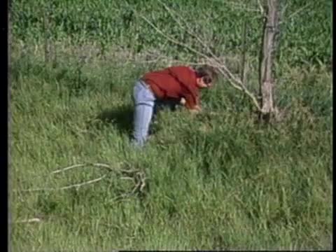
Oh yeah this is one of the common small mammals that you'll find throughout Iowa for that matter. His name is another name he doesn't look much like a deer. You got a white stomach back. This one is an adult I was just trying to see if he was molding Dr. Rick Lampy is studying small mammal populations or critters if you prefer here and elsewhere in the valley. This species is primarily vegetarian although they'll take the fruits when they're available. Some insects when they're available. Fungus or learning a number of these small mammals are eating not so much out here in the grasslands but in forests they're eating a lot of fungus
so and they become food then for many of the carnivores the mouse we have here although it's an exotic in the sense that it's an introduced species does occur in these areas especially in the agricultural areas that we were trapping in this morning. It's the house mouse. The colors are just the light brown. When people think of mice they're thinking of this guy in particular and dark back slightly lighter stomach and the tail of his hair less and you can get the very distinct rings on the tail. As you learn about these little animals you want to learn things about the creatures they eat and the creatures that eat them. What we have here is not a mouse. These are shrews. This is a common
member of the grassland community. It's called A Short tailed shrew. People will see these but not know what they are. You commonly see them crossing roads. They're pretty avoid Peter as do most. They have a high metabolism they have to eat not continuously but they have to eat frequently. This one is a predator it will eat mice. You'll find it out here in grasslands. Not so much in the forests. It is an insect of war. The order Insectivora. So it's not a rodent. It's different from the mice that we've been talking about. We're here trying to learn about the natural history of these animals so that we can preserve them for posterity so that we can understand the space of the Earth keeps on going
exactly how it all operates. It's very hard to know what kind of information will be needed 10 years from now 50 years from now if we did we wouldn't have to go on all of the hard work that's involved in learning. We could just say this is important and we don't need the rest of it. But since we can't do that. We have to try our very best in understanding as much about the natural systems as we can learn and thereby safeguard everyone's welfare and the organisms that we're studying here as well as yours and mine. Too soon it seems the summer dance is over and the kettle prairie drops its finery in the fall preparing for winter. There seemed to be no end to the variety of unique geological formations created by the
Des Moines lobe of the Wisconsin glacier. I'm standing among them are Iowa's Great Lakes. Great holes in the land some shallow Some deep. Guy would you doubt by the Des Moines Low been filled with water as it wasted away. Some places the glacial bulldozer and quirks inherent in the land combine to form strange alien environments. And they can think Conny we have an opportunity to see some of the really quasi glacially foreign landscapes in the little valley nearby is promising some of these unique regions here in Dickinson County. This is. Cation is the Silverlake fan state preserve and fans are very unusual occurrences of up welling groundwater that is very highly mineralized. In this case it's an alkaline rich and sulphate Ridge groundwater which is upwelling at this location resulting in the appearance of numerous
pools in an offline location and then gradually working down slope into these numerous shallow pools that we see here. The ground is very spongy very body. As you walk over it it is almost quakes you can just feel it. The ground surface jiggling under your feet and these little pools are very highly Mehra lies pools. You can see the lime rich water in crossing the vegetation that's growing in these pools with kind of a coating of white. And this is a very interesting area not only to geologists but to the botanists and zoologists who study the plants and animals associated with this very specialized habitat. Friends are a niche of the wetlands that once nearly covered the Perrys of the Des Moines lo. It is here in the wetlands of north central Iowa and South Central Minnesota. The Little Sioux begins. The exact location of the lucerne
river being hard to distinguish from Mars or bog at times. It is a harsh almost confusing habitat for those creatures who stay here year round. For in a short period of time this area can change from shallow flooded plain to a flowing river bordered by Marsh to a dusty riverbed with tiny stagnant pools to well anything in between. OK very good. We've got a collection here that's pretty typical of this type of river. It's what we call a collection of Pioneer fishes type of river system is really a very rigorous habitat floods in the spring time often becomes dry and intermittent in the summer takes a pretty tough fish to survive this type of thing. So let's take a look at some of our common inhabitants here. We've picked up quite a few black bullheads
bullheads are very typical of marshes and small streams in the area. We've got a small northern clay. The Northern Pike is another fish. Most fishermen know it doesn't like this but it's really very common in the small prairie streams and marshes. The last species of fish that we've got here this looks like a small blue bullhead but it's called a mad Tom. This is called the tadpole mad Tom. It's called that because it bears some resemblance to a tadpole. And it's a typical Marsh dwelling mad mad times or interesting little fishes because among other things they bear. A pectoral fin spine or shoulder fin spine that contains a venom and this animal can give you a sting much like
a bee sting. That's a rigorous habitat makes for a hard life but still left to their own bees marshes and streamlets represent a healthy natural system. And the reason for this has as much to do with the land as it does with the river. This is a classic example of a green belt around a river. This is not these hills are NOT have not been plowed. And one of the reasons is the solid gravel. But fortunately that means that these slopes have been protected and this side is all marshland. It floods your camp. It floods too often. So this is the classical green belt. In other words this does not have row crops farming down to the water's edge which is the which is the disaster just by streams and agricultural land streams and agricultural land are essential and this is the heart of Iowa. The water in these meandering Rivers
irrigates all of Iowa in a beautiful fashion. But this kind of belt along the so-called green belt is nature's tertiary treatment filter. It takes everything. Which would have normally enriched the waters and cause sometimes heavy pollution as a result of that from the richness of the soil washing it. It is still a rich river but it is controlled by this belt which acts as a filter a giant sponge of green which protects the waters of the stream. Would that every stream and I had such a greenbelt along it it would protect the stream enormously. And what a great place for kids to see Rivers. But a great place for for people to fish for bikers to bike and a place of peace and quiet and one of the real beauties of these natural streams. When these green belts are cleared there are winners and losers. It
isn't that simple of course. Trying to fit nature on an accountant's balance sheet means some tough and the toughest part is that once some decisions are made there's no going back. This is where we came this spring to bring our classes to study a very very delightful little book that I'm just a little alone and this is where we found the creek was gone and instead we have this channeled ditch which was dug this year history of this ditch. It goes back to prior to World War One. There was a little brook here a natural brook the drain in the little sow behind us here were three like small lakes very shallow and at a time when they wanted to increase agricultural production and World War One they drained those by digging this ditch through here we are now farming those and we're reaping the economic advantages of having drained but we are also at the same time losing the
extraordinary diversity of life that used to be here of necessity to feed the world but that's not replaceable. There's something about complexity which is essential or at least very admirable that we're losing. This is monotonous. This is deadly monotonous. And the diversity of species. It is now almost zero and when it comes back it will be much lower than it was. We've seen that time and again that is lost and that we will not again. And that has something to do with the quality of life in Iowa people's enjoyment of it as well as the balance of nature. My hours about my apologies if you were looking for a slam bam finish but
there's a reason for this little bit of Iowa style America these folks are dedicating the O to the mound as a state preserve. It may seem a little corny but when you think about it. Look at the faces youre looking at the crowning glory of five billion years of natural heritage. The result of events both awesome in minute can be seen and heard in something as simple as the valiant attempt of a high school band to bring some pomp and ceremony to the case. When you look at the story of the Little Sioux River Valley and its just one of a million stories about the land between two rivers you cant help but think what a strange and marvelous creation it is and how tremendously we benefit from it. Many Iowans know how much their very existence is tied to the land. The point of all this is that like it or not we're all tied up in this great scheme of water land and life.
It's just a plain fact that the number of plants and animals that have handed out the exit marked dinosaurs is downright terrifying. What do you make out of this fact is your own business. Me I got to wonder if maybe we aren't walking backwards toward that door. The preceding program was made possible through a grant from the Kennedy
Lindstrom foundation incorporated a charitable trust Mason City Iowa.
- Series
- Land Between Two Rivers
- Episode Number
- 105-Is
- Episode
- Little Sioux River: The, Part 1
- Producing Organization
- Iowa Public Television
- Contributing Organization
- Iowa PBS (Johnston, Iowa)
- AAPB ID
- cpb-aacip-37-085hqcwj
If you have more information about this item than what is given here, or if you have concerns about this record, we want to know! Contact us, indicating the AAPB ID (cpb-aacip-37-085hqcwj).
- Description
- Series Description
- Land Between Two Rivers is a documentary series exploring Iowa's nature and natural history.
- Description
- Episode 105-IS "Little Sioux River part 1" Rec 10-30-1985
- Created Date
- 1985-10-30
- Asset type
- Episode
- Genres
- Documentary
- Rights
- Inquiries may be submitted to archives@iowapbs.org.
- Media type
- Moving Image
- Duration
- 00:30:24
- Credits
-
-
Producing Organization: Iowa Public Television
- AAPB Contributor Holdings
-
Iowa Public Television
Identifier: cpb-aacip-ec5e1f8b282 (Filename)
Format: U-matic
Generation: Dub
Duration: 00:28:48
If you have a copy of this asset and would like us to add it to our catalog, please contact us.
- Citations
- Chicago: “Land Between Two Rivers; 105-Is; Little Sioux River: The, Part 1,” 1985-10-30, Iowa PBS, American Archive of Public Broadcasting (GBH and the Library of Congress), Boston, MA and Washington, DC, accessed March 18, 2026, http://americanarchive.org/catalog/cpb-aacip-37-085hqcwj.
- MLA: “Land Between Two Rivers; 105-Is; Little Sioux River: The, Part 1.” 1985-10-30. Iowa PBS, American Archive of Public Broadcasting (GBH and the Library of Congress), Boston, MA and Washington, DC. Web. March 18, 2026. <http://americanarchive.org/catalog/cpb-aacip-37-085hqcwj>.
- APA: Land Between Two Rivers; 105-Is; Little Sioux River: The, Part 1. Boston, MA: Iowa PBS, American Archive of Public Broadcasting (GBH and the Library of Congress), Boston, MA and Washington, DC. Retrieved from http://americanarchive.org/catalog/cpb-aacip-37-085hqcwj